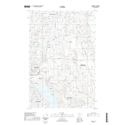
2020 Map of Redmond
USGS Topo · Published 2020About this map
Lake Sammamish and the meandering Snoqualmie River define the eastern suburbs of the Puget Sound region in this 2020 record. The landscape shows a complex transition from the dense residential grids of Bellevue and Redmond to the sprawling equestrian and wooded estates of Cottage Lake and Union Hill-Novelty Hill. Utility corridors serve as modern landmarks, with the Tolt Pipeline Trail and Puget Power Powerline Trail cutting distinct paths across the terrain. Significant green spaces, including the Redmond Watershed and Eastside Memorial Park, are preserved amidst the suburban growth of Sammamish and Sahalee. Small water bodies like Welcome Lake and Peterson Pond dot the uplands, while drainage from Bear Cr and Evans Cr illustrates the area's intricate hydrology.
Find a feature on this map
39 named features on this map. Tap any name to fly to it.
Don’t see what you’re looking for? This feature index may not catch every label — zoom into the map to look around manually.
Map Details
Editions of this 2020 Redmond Map
This is the sole edition of this map. No revisions or reprints were ever made.
Other maps of this area

1895 · Snohomish
USGS Topo · 1:125,000

1897 · Seattle
USGS Topo · 1:125,000

1921 · Sultan
USGS Topo · 1:125,000

1923 · Sultan
USGS Topo · 1:125,000

1944 · Everett
USGS Topo · 1:62,500

1950 · Redmond
USGS Topo · 1:24,000
1950 · Mercer Island
USGS Topo · 1:24,000

1950 · Issaquah
USGS Topo · 1:24,000

1950 · Kirkland
USGS Topo · 1:24,000

1953 · Monroe
USGS Topo · 1:24,000