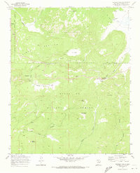
1970 Map of Redondo Peak
USGS Topo · Published 1973About this map
Redondo Peak dominates the northern landscape of this volcanic terrain, marking the heart of the Valles Caldera. This 1970 survey illustrates a complex geography of mountain domes and expansive high-altitude meadows, most notably the Valle Grande and the sprawling Baca Location No 1 private land grant. The mapping of this era captures the transition between private ranching operations, such as the Headquarters Ranch and Triple H Ranch, and the public lands of the Santa Fe National Forest.
Find a feature on this map
32 named features on this map. Tap any name to fly to it.
Don’t see what you’re looking for? This feature index may not catch every label — zoom into the map to look around manually.
Map Details
Editions of this 1970 Redondo Peak Map
4 editions found
Other maps of this area

1890 · Jemes
USGS Topo · 1:125,000

1892 · Jemes
USGS Topo · 1:125,000

1892 · Santa Clara
USGS Topo · 1:125,000

1937 · Jemez Springs
USGS Topo · 1:48,000

1943 · Jemez
USGS Topo · 1:62,500

1944 · Jemez Springs
USGS Topo · 1:62,500

1952 · Valle Toledo
USGS Topo · 1:24,000

1952 · Jemez Springs
USGS Topo · 1:62,500

1952 · Jemez
USGS Topo · 1:62,500

1953 · Bland
USGS Topo · 1:24,000