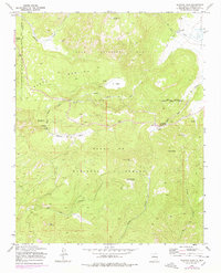
1970 Map of Redondo Peak
USGS Topo · Published 1978About this map
Redondo Peak dominates this high-altitude landscape within the Santa Fe National Forest, marking a region defined by dramatic volcanic topography and deep drainages. In the 1970s, the area served as a significant recreational and ranching hub, with numerous sites like Redondo Campground, Banco Bonito Campground, and Las Conchas Campground distributed along the waterways. The presence of Headquarters Ranch and Triple H Ranch highlights the ongoing agricultural use of the open valleys, while the Cerro Pelado Lookout provided a critical vantage point for forest management.
Find a feature on this map
32 named features on this map. Tap any name to fly to it.
Don’t see what you’re looking for? This feature index may not catch every label — zoom into the map to look around manually.
Map Details
Editions of this 1970 Redondo Peak Map
4 editions found
Other maps of this area

1890 · Jemes
USGS Topo · 1:125,000

1892 · Jemes
USGS Topo · 1:125,000

1892 · Santa Clara
USGS Topo · 1:125,000

1937 · Jemez Springs
USGS Topo · 1:48,000

1943 · Jemez
USGS Topo · 1:62,500

1944 · Jemez Springs
USGS Topo · 1:62,500

1952 · Valle Toledo
USGS Topo · 1:24,000

1952 · Jemez Springs
USGS Topo · 1:62,500

1952 · Jemez
USGS Topo · 1:62,500

1953 · Bland
USGS Topo · 1:24,000