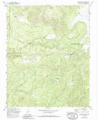
1970 Map of Redondo Peak
USGS Topo · Published 1986About this map
Redondo Peak dominates this mountainous landscape within the Santa Fe National Forest, rising above the sprawling basin of Baca Location No 1 and the high grasslands of Valle Grande. The 1970 field check reveals a network of primitive access routes, including a Jeep Trail winding past Headquarters Ranch and several Pack Trails threading through the canyons. Water serves as a primary organizing force for settlement and recreation, with the East Fork Jemez River supporting the Las Conchas Campground and the Banco Bonito area providing a base for higher-elevation camps. The presence of a lookout on Cerro Pelado and a Gravel Pit near Redondo Creek indicates the active management of these timbered lands, while labels like Vallecitos de los Indios hint at the deep cultural history of the Jemez Mountains.
Find a feature on this map
30 named features on this map. Tap any name to fly to it.
Don’t see what you’re looking for? This feature index may not catch every label — zoom into the map to look around manually.
Map Details
Editions of this 1970 Redondo Peak Map
4 editions found
Other maps of this area

1890 · Jemes
USGS Topo · 1:125,000

1892 · Jemes
USGS Topo · 1:125,000

1892 · Santa Clara
USGS Topo · 1:125,000

1937 · Jemez Springs
USGS Topo · 1:48,000

1943 · Jemez
USGS Topo · 1:62,500

1944 · Jemez Springs
USGS Topo · 1:62,500

1952 · Valle Toledo
USGS Topo · 1:24,000

1952 · Jemez Springs
USGS Topo · 1:62,500

1952 · Jemez
USGS Topo · 1:62,500

1953 · Bland
USGS Topo · 1:24,000