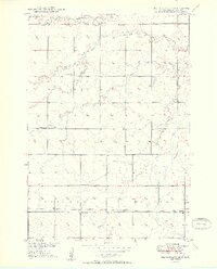
1950 Map of Ree Heights SE
USGS Topo · Published 1950About this map
The rural prairie of Green Leaf, Alpha, and Midland townships reflects a mid-century agricultural landscape defined by its drainages and small community hubs. Meandering waterways including Wolf Creek and Turtle Creek dictate the local topography, which was mapped in the late 1940s as part of the Missouri River Basin development program. The distribution of neighborhood schools like Prairie View Sch and Spiers Sch across the grid highlights the decentralized nature of rural education before modern consolidation.
Find a feature on this map
17 named features on this map. Tap any name to fly to it.
Don’t see what you’re looking for? This feature index may not catch every label — zoom into the map to look around manually.
Map Details
Editions of this 1950 Ree Heights SE Map
2 editions found
Other maps of this area

1899 · Redfield
USGS Topo · 1:125,000

1949 · Ree Heights NW
USGS Topo · 1:24,000

1950 · Ree Heights SE
USGS Topo · 1:24,000

1950 · Vayland NW
USGS Topo · 1:24,000

1950 · Ree Heights
USGS Topo · 1:24,000

1951 · Ree Heights NW
USGS Topo · 1:24,000

1951 · Ree Heights NE
USGS Topo · 1:24,000

1953 · Huron
USGS Topo · 1:250,000

1954 · Huron
USGS Topo · 1:250,000

1967 · Miller
USGS Topo · 1:24,000