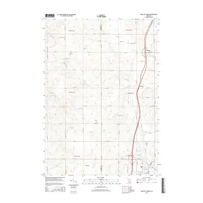
2014 Map of Reed City North
USGS Topo · Published 2014About this map
The Hersey River and its numerous tributaries, including Burt Cr and Jewitt Cr, carve through the glacial landscape along the border of Lake and Osceola Counties. In this 2014 edition, the settlement patterns of the northern Michigan interior are clearly defined, from the northern edge of Reed City to the small communities of Orono and Ashton. The map is particularly notable for its dense cluster of historic burial grounds, such as Pinora Cem, German Cem, and Wilson Cem, which speak to the area's late 19th and early 20th-century rural heritage. Transportation corridors are anchored by the north-south highway running through Orono and the local road network that connects sites like the Nartron Field Airport and the shores of Deer Lake. This survey provides a modern snapshot of a region where old family landmarks and rural churches, like Trinity Lutheran Cem, remain foundational to the landscape.
Find a feature on this map
83 named features on this map. Tap any name to fly to it.
Don’t see what you’re looking for? This feature index may not catch every label — zoom into the map to look around manually.
Map Details
Editions of this 2014 Reed City North Map
This is the sole edition of this map. No revisions or reprints were ever made.
Other maps of this area

1931 · Chase NE
USGS Topo · 1:31,680

1932 · Chase NW
USGS Topo · 1:31,680

1933 · Luther SE
USGS Topo · 1:31,680

1933 · Luther SW
USGS Topo · 1:31,680

1954 · Traverse City
USGS Topo · 1:250,000

1954 · Midland
USGS Topo · 1:250,000

1957 · Cadillac South
USGS Topo · 1:62,500

1957 · Luther
USGS Topo · 1:62,500

1958 · Traverse City
USGS Topo · 1:250,000

1958 · Midland
USGS Topo · 1:250,000