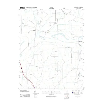
2012 Map of Reevesville
USGS Topo · Published 2012About this map
Renshaw and Reevesville anchor this southern Illinois landscape, where the flatlands meet the wooded rising ground of the Shawnee National Forest. The map reveals a deeply rural character defined by drainage systems like Bay Creek and Gurley Ditch, which dictate the placement of roads and small agricultural hubs. Numerous family cemeteries are scattered throughout the quadrangle, including Mount Olive Cem, Macedonia Cem, and Sassafras Cem, providing essential markers for genealogists tracing the legacy of Pope County settlers. To the south and east, the settlements of Big Bay and Temple Hill appear alongside landmarks such as Stafford Bluff and Allens Spring. The map's detail, including the grid of rural routes like Jefferson School Rd, illustrates the persistent infrastructure of a community shaped by its hydrology and timber resources.
Find a feature on this map
60 named features on this map. Tap any name to fly to it.
Don’t see what you’re looking for? This feature index may not catch every label — zoom into the map to look around manually.
Map Details
Editions of this 2012 Reevesville Map
This is the sole edition of this map. No revisions or reprints were ever made.
Other maps of this area

1917 · Brownfield
USGS Topo · 1:62,500

1918 · Vienna
USGS Topo · 1:62,500

1919 · Vienna
USGS Topo · 1:62,500

1926 · Paducah
USGS Topo · 1:62,500

1928 · La Center
USGS Topo · 1:62,500

1929 · Paducah
USGS Topo · 1:62,500

1932 · La Center
USGS Topo · 1:62,500

1940 · Paducah
USGS Topo · 1:62,500

1942 · Vienna
USGS Topo · 1:62,500

1949 · Paducah
USGS Topo · 1:250,000