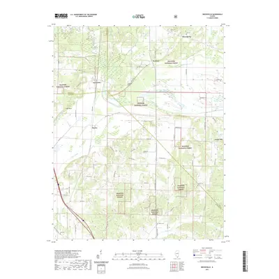
2021 Map of Reevesville
USGS Topo · Published 2021About this map
Reevesville and the surrounding southern Illinois lowlands are defined by a complex network of managed waterways including the Bay Cr Ditch and Bear Cr Ditch. This 2021 survey shows how the landscape transition between the Shawnee National Forest and the agricultural flatlands is mediated by these drainage features and the winding course of Bay Creek. Small settlements like Renshaw, Big Bay, and Temple Hill are interconnected by a grid of rural routes such as Big Bay Rd and Illinois 145 Rd. For local historians and genealogists, the map is a primary record of area burial sites, from Mount Olive Cem near Stafford Bluff to the more isolated Canaan Cem. The terrain is punctuated by distinctive landforms like Cagle Bluff, which rise above the wetlands and sloughs of the Massac Cr watershed.
Find a feature on this map
67 named features on this map. Tap any name to fly to it.
Don’t see what you’re looking for? This feature index may not catch every label — zoom into the map to look around manually.
Map Details
Editions of this 2021 Reevesville Map
This is the sole edition of this map. No revisions or reprints were ever made.
Other maps of this area

1917 · Brownfield
USGS Topo · 1:62,500

1918 · Vienna
USGS Topo · 1:62,500

1919 · Vienna
USGS Topo · 1:62,500

1926 · Paducah
USGS Topo · 1:62,500

1928 · La Center
USGS Topo · 1:62,500

1929 · Paducah
USGS Topo · 1:62,500

1932 · La Center
USGS Topo · 1:62,500

1940 · Paducah
USGS Topo · 1:62,500

1942 · Vienna
USGS Topo · 1:62,500

1949 · Paducah
USGS Topo · 1:250,000