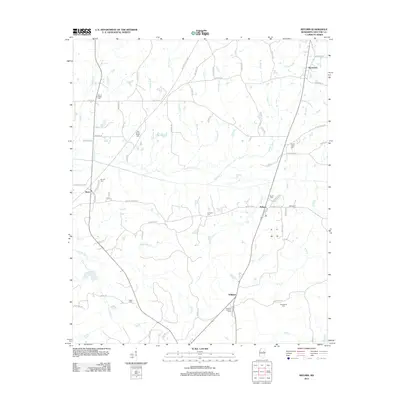
2012 Map of Reform
USGS Topo · Published 2012About this map
Reform and the surrounding Choctaw County landscape are defined by a complex network of creeks and numerous rural burial grounds. The territory is drained by waterways such as Blythe Cr, Middle Bywy Cr, and Rhiner Cr, which weave through a landscape marked by longstanding community landmarks. Genealogists will find significant value in the distribution of cemeteries, including Mount Pisgah Cem, Old Mount Pisgah Cem, Bethsalem Cem, and Nebo Cem, many of which sit adjacent to family-named roads like Pilgrim's Rest Rd and Weaver Dr. Near the settlement of Williams, the Choctaw Lookout Tower stands as a prominent point in the local topography. This 2012 survey documents the persistent rural character of the region, where the Natchez Trace Pkwy and Old Trace Rd intersect the modern road system, reflecting the area's deep historical transit roots.
Find a feature on this map
78 named features on this map. Tap any name to fly to it.
Don’t see what you’re looking for? This feature index may not catch every label — zoom into the map to look around manually.
Map Details
Editions of this 2012 Reform Map
This is the sole edition of this map. No revisions or reprints were ever made.
Other maps of this area

1953 · Walthall
USGS Topo · 1:62,500

1953 · West Point
USGS Topo · 1:250,000

1958 · West Point
USGS Topo · 1:250,000

1963 · West Point
USGS Topo · 1:250,000

1966 · Weir
USGS Topo · 1:24,000

1966 · Tomnolen
USGS Topo · 1:24,000

1968 · Weir
USGS Topo · 1:62,500

1972 · Maben
USGS Topo · 1:24,000

1972 · Sapa
USGS Topo · 1:24,000

1972 · Double Springs
USGS Topo · 1:24,000