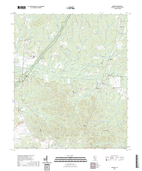
2024 Map of Reform
USGS Topo · Published 2024About this map
The Natchez Trace Parkway bisects this section of Choctaw County, following the natural ridges above the drainage systems of Big Bywy Ditch and Phillips Creek. This modern survey of the Reform area preserves the locations of numerous historic congregational sites and family burial grounds that define the local genealogy, including Antioch Community Church-Cem and Mount Pisgah Baptist Church-Cem. The landscape is characterized by the transition from the Noxubee Hills in the south toward the intricate network of creeks like Middle Bywy Creek and Little Bywy Creek in the west. Local road names such as Pilgrim's Rest Rd and Old Trace Rd reflect the area's long-standing connection to the historic travel corridor, while small settlements like Bywy, Williams, and Sherwood serve as anchors for the surrounding rural homesteads and farms.
Find a feature on this map
91 named features on this map. Tap any name to fly to it.
Don’t see what you’re looking for? This feature index may not catch every label — zoom into the map to look around manually.
Map Details
Editions of this 2024 Reform Map
This is the sole edition of this map. No revisions or reprints were ever made.
Other maps of this area

1953 · Walthall
USGS Topo · 1:62,500

1953 · West Point
USGS Topo · 1:250,000

1958 · West Point
USGS Topo · 1:250,000

1963 · West Point
USGS Topo · 1:250,000

1966 · Weir
USGS Topo · 1:24,000

1966 · Tomnolen
USGS Topo · 1:24,000

1968 · Weir
USGS Topo · 1:62,500

1972 · Maben
USGS Topo · 1:24,000

1972 · Sapa
USGS Topo · 1:24,000

1972 · Double Springs
USGS Topo · 1:24,000