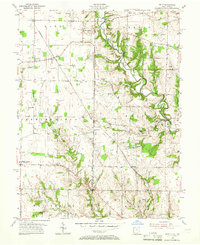
1955 Map of Reily
USGS Topo · Published 1966About this map
The Indian Creek valley and the high agricultural plateaus of the Ohio-Indiana border define this mid-century landscape. The First Principal Meridian serves as a stark geographic divide, separating Franklin and Butler counties while marking the state line between Indiana and Ohio. Settlement patterns are anchored by rural hamlets like Reily and Peoria, with the Chesapeake and Ohio railroad cutting a diagonal path through the northwest corner near Raymond.
Find a feature on this map
50 named features on this map. Tap any name to fly to it.
Don’t see what you’re looking for? This feature index may not catch every label — zoom into the map to look around manually.
Map Details
Editions of this 1955 Reily Map
Other maps of this area

1911 · Oxford
USGS Topo · 1:62,500

1915 · College Corner
USGS Topo · 1:48,000

1915 · Harrison
USGS Topo · 1:48,000

1915 · Hamilton
USGS Topo · 1:62,500

1917 · Hamilton
USGS Topo · 1:62,500

1918 · College Corner
USGS Topo · 1:62,500

1948 · Fairfield
USGS Topo · 1:24,000

1953 · Cincinnati
USGS Topo · 1:250,000

1955 · Harrison
USGS Topo · 1:24,000

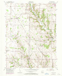
1955 · Reily
USGS Topo · 1:24,000