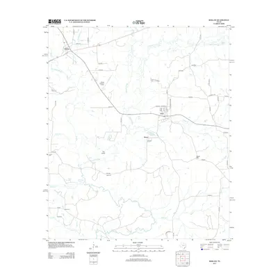
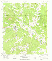
2013 Map of Reklaw
USGS Topo · Published 2013About this map
The Angelina River meanders through this landscape, defining a complex system of bottomlands and oxbows including Rutherford Slough, Boatman Slough, and Jolly Lake. This 2013 survey of the Reklaw quadrangle illustrates the persistent rural character of the region, where small settlements like Reklaw, Sacul, and Dextra are linked by a network of county roads. Genealogists will find notable value in the locations of Looney Cem, Ward Cem, and Martin Cem, which anchor the history of these communities. The topography is largely low-lying river drainage, though Beard Mtn and the elevated area of Pine Island provide distinct relief amidst the tributaries of Mud Cr and Beech Cr. Practical modern infrastructure, such as the Flying M Ranch Airport, sits alongside long-established local routes like the Old New Salem Hwy.
Find a feature on this map
64 named features on this map. Tap any name to fly to it.
Don’t see what you’re looking for? This feature index may not catch every label — zoom into the map to look around manually.
Map Details
Editions of this 2013 Reklaw Map
This is the sole edition of this map. No revisions or reprints were ever made.
Other maps of this area
1943 · Cushing
USGS Topo · 1:62,500
1943 · Rusk
USGS Topo · 1:62,500
1945 · Cushing
USGS Topo · 1:62,500
1945 · Rusk
USGS Topo · 1:62,500
1946 · Alto
USGS Topo · 1:62,500
1952 · Douglass
USGS Topo · 1:62,500

1953 · Palestine
USGS Topo · 1:250,000

1957 · Palestine
USGS Topo · 1:250,000
1973 · New Summerfield
USGS Topo · 1:24,000
1973 · Cushing
USGS Topo · 1:24,000