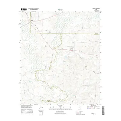
2016 Map of Reklaw
USGS Topo · Published 2016About this map
The Angelina River meanders through this East Texas landscape, forming the winding border between Cherokee, Rusk, and Nacogdoches counties. The settlement of Reklaw is situated at the northern edge, where the grid of W Main St and E Main St meets Old Sacul Rd. Further south, the community of Sacul and the small locale of Bermuda are tucked between the river's wetlands and the rising elevation of Beard Mtn. The terrain is defined by a dense network of hydrologic features including Boatman Slough, Jolly Lake, and Lucas Lake, reflecting the bottomland character of the river valley. Genealogists will find the Ward Cem and Martin Cem located along rural routes like Dextra Rd, while the Flying M Ranch Airport serves as a modern waypoint in this largely rural expanse of forest and creek beds.
Find a feature on this map
62 named features on this map. Tap any name to fly to it.
Don’t see what you’re looking for? This feature index may not catch every label — zoom into the map to look around manually.
Map Details
Editions of this 2016 Reklaw Map
This is the sole edition of this map. No revisions or reprints were ever made.
Other maps of this area

1943 · Cushing
USGS Topo · 1:62,500

1943 · Rusk
USGS Topo · 1:62,500

1945 · Cushing
USGS Topo · 1:62,500

1945 · Rusk
USGS Topo · 1:62,500

1946 · Alto
USGS Topo · 1:62,500

1952 · Douglass
USGS Topo · 1:62,500

1953 · Palestine
USGS Topo · 1:250,000

1957 · Palestine
USGS Topo · 1:250,000
1973 · New Summerfield
USGS Topo · 1:24,000

1973 · Cushing
USGS Topo · 1:24,000