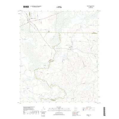
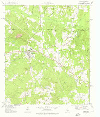
2019 Map of Reklaw
USGS Topo · Published 2019About this map
Angelina River meanders along the intersection of Cherokee, Rusk, and Nacogdoches Counties, defining a landscape of wetlands and riverine lowlands. The settlement of Reklaw sits in the northwest near the confluence of White Oak Cr and Mud Cr, while the community of Sacul occupies the higher ground to the east. The terrain transitions from the marshy reaches of Boatman Slough and Rutherford Slough to the prominent rise of Beard Mtn. Genealogists will find several family landmarks, including Looney Cem, Ward Cem, and Martin Cem. The presence of the Flying M Ranch Airport and the isolated location of Pine Island within the river bends reflect the modern rural character of this East Texas timber and ranching region.
Find a feature on this map
70 named features on this map. Tap any name to fly to it.
Don’t see what you’re looking for? This feature index may not catch every label — zoom into the map to look around manually.
Map Details
Editions of this 2019 Reklaw Map
This is the sole edition of this map. No revisions or reprints were ever made.
Other maps of this area
1943 · Cushing
USGS Topo · 1:62,500
1943 · Rusk
USGS Topo · 1:62,500
1945 · Cushing
USGS Topo · 1:62,500
1945 · Rusk
USGS Topo · 1:62,500
1946 · Alto
USGS Topo · 1:62,500
1952 · Douglass
USGS Topo · 1:62,500

1953 · Palestine
USGS Topo · 1:250,000

1957 · Palestine
USGS Topo · 1:250,000
1973 · New Summerfield
USGS Topo · 1:24,000
1973 · Cushing
USGS Topo · 1:24,000