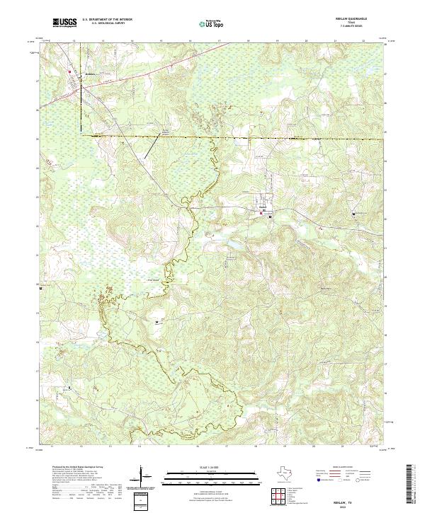
2022 Map of Reklaw
USGS Topo · Published 2022About this map
Reklaw and Sacul anchor this landscape where the boundaries of Rusk, Cherokee, and Nacogdoches counties meet. The terrain is defined by the winding course of the Angelina River and its associated wetlands, including Rutherford Slough, Boatman Slough, and the quiet waters of Grassy Lake. This low-lying drainage system contrasts with the prominent rise of Beard Mtn to the southeast, illustrating the transition from river bottomlands to the wooded uplands of East Texas.
Find a feature on this map
71 named features on this map. Tap any name to fly to it.
Don’t see what you’re looking for? This feature index may not catch every label — zoom into the map to look around manually.
Map Details
Editions of this 2022 Reklaw Map
This is the sole edition of this map. No revisions or reprints were ever made.
Other maps of this area

1943 · Cushing
USGS Topo · 1:62,500

1943 · Rusk
USGS Topo · 1:62,500

1945 · Cushing
USGS Topo · 1:62,500

1945 · Rusk
USGS Topo · 1:62,500

1946 · Alto
USGS Topo · 1:62,500

1952 · Douglass
USGS Topo · 1:62,500

1953 · Palestine
USGS Topo · 1:250,000

1957 · Palestine
USGS Topo · 1:250,000
1973 · New Summerfield
USGS Topo · 1:24,000

1973 · Cushing
USGS Topo · 1:24,000