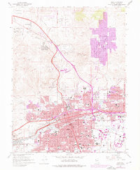
1967 Map of Reno
USGS Topo · Published 1976About this map
The Truckee River and Southern Pacific railroad corridor anchor this mid-1960s survey of the Nevada landscape, documenting a period of rapid urbanization. Urban expansion is visible through purple revisions in Sun Valley and the northern reaches of Reno and Sparks. The map illustrates the transition from a resource-based economy to a regional service and transportation hub, as evidenced by the proximity of the US Bureau of Mines and several active mining sites like the Reno Mizpah Mine to the growing Reno International Airport.
Find a feature on this map
89 named features on this map. Tap any name to fly to it.
Don’t see what you’re looking for? This feature index may not catch every label — zoom into the map to look around manually.
Map Details
Editions of this 1967 Reno Map
4 editions found
Other maps of this area

1891 · Carson
USGS Topo · 1:125,000

1891 · Reno
USGS Topo · 1:125,000

1893 · Carson
USGS Topo · 1:125,000

1893 · Reno
USGS Topo · 1:125,000

1950 · Virginia City
USGS Topo · 1:62,500

1950 · Mt. Rose
USGS Topo · 1:62,500

1950 · Reno
USGS Topo · 1:62,500

1951 · Reno
USGS Topo · 1:62,500

1952 · Mt. Rose
USGS Topo · 1:62,500

1952 · Virginia City
USGS Topo · 1:62,500