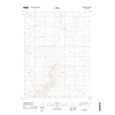
2019 Map of Reservoir Draw
USGS Topo · Published 2019About this map
Powder Wash and several significant ephemeral drainage systems define this high-desert landscape in northern Moffat County. The map captures a topography shaped by water erosion, where Horse Draw and Ruedloff Draw carve through the arid terrain toward larger watercourses. To the southeast, the Little Snake River provides a permanent water source that contrasts with the seasonal nature of the surrounding draws.
Find a feature on this map
14 named features on this map. Tap any name to fly to it.
Don’t see what you’re looking for? This feature index may not catch every label — zoom into the map to look around manually.
Map Details
Editions of this 2019 Reservoir Draw Map
This is the sole edition of this map. No revisions or reprints were ever made.
Other maps of this area

1954 · Vernal
USGS Topo · 1:250,000

1954 · Rock Springs
USGS Topo · 1:250,000

1958 · Vernal
USGS Topo · 1:250,000

1958 · Rock Springs
USGS Topo · 1:250,000

1960 · Vernal
USGS Topo · 1:250,000

1962 · Rock Springs
USGS Topo · 1:250,000

1969 · Reservoir Draw
USGS Topo · 1:24,000
1969 · The Nipple SE
USGS Topo · 1:24,000

1969 · The Nipple
USGS Topo · 1:24,000
1969 · The Nipple NE
USGS Topo · 1:24,000