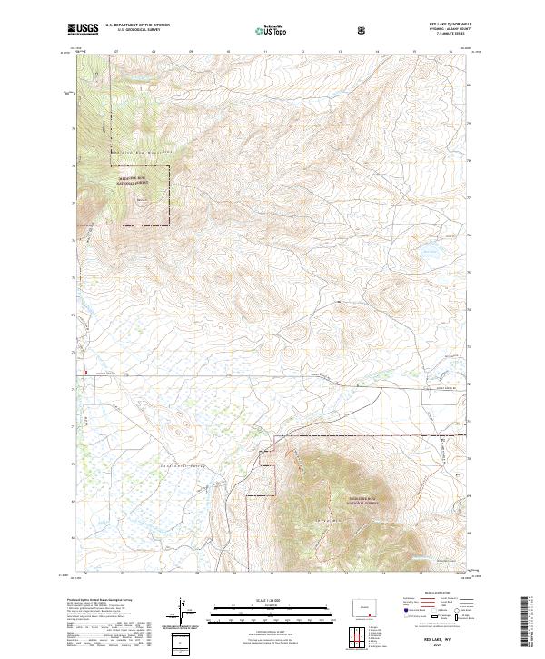
2021 Map of Rex Lake
USGS Topo · Published 2021About this map
Medicine Bow National Forest dominates the high ground in this part of Albany County, where the peaks of the Medicine Bow Mountains descend into the productive ranching lands of the Centennial Valley. Significant peaks like Bald Mtn and the massive Sheep Mtn define the topography, with the latter featuring a dedicated network of paths including the Sheep Mountain Trl and Sheep Mt North Access Trl. The valley floor is characterized by an intricate system of water management, illustrated by the Bellamy Ditch, Adams Ditch, and N Fork Ditch Number 2 which divert water from the Little Laramie River system to support the arid landscape near Rex Lake. Modern access via Snowy Range Rd follows the historical corridor between the mountain range and the surrounding gulches and creeks.
Find a feature on this map
34 named features on this map. Tap any name to fly to it.
Don’t see what you’re looking for? This feature index may not catch every label — zoom into the map to look around manually.
Map Details
Editions of this 2021 Rex Lake Map
This is the sole edition of this map. No revisions or reprints were ever made.
Other maps of this area

1895 · Laramie
USGS Topo · 1:125,000

1902 · Laramie
USGS Topo · 1:125,000

1905 · Laramie
USGS Topo · 1:125,000

1906 · Medicine Bow
USGS Topo · 1:125,000

1906 · Laramie
USGS Topo · 1:125,000

1908 · Laramie
USGS Topo · 1:125,000

1908 · Medicine Bow
USGS Topo · 1:125,000

1954 · Cheyenne
USGS Topo · 1:250,000

1954 · Rawlins
USGS Topo · 1:250,000

1958 · Rawlins
USGS Topo · 1:250,000