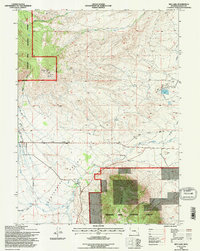
1992 Map of Rex Lake
USGS Topo · Published 1996About this map
Centennial Valley anchors this high-altitude landscape in the early 1990s, where the western foothills of Sheep Mountain descend toward the Little Laramie River. The map captures an area defined by irrigation and resource extraction, specifically the Rex Lake Oil Field surrounding the waters of Rex Lake. A complex network of water management features, such as Bellamy Ditch, Adams Ditch, and Dominic DITCH, indicates a valley floor engineered for livestock or agriculture. The northern edge of the sheet transitions into the Medicine Bow National Forest, rising toward Bald Mtn and Corner Mtn. The Union Pacific rail line cuts across the terrain, serving as a primary corridor through this sparsely populated stretch of Wyoming. Numerous Gravel Pits and Prospects scattered near the Forest Boundary reflect the local geological utility and history of mineral exploration.
Find a feature on this map
28 named features on this map. Tap any name to fly to it.
Don’t see what you’re looking for? This feature index may not catch every label — zoom into the map to look around manually.
Map Details
Editions of this 1992 Rex Lake Map
This is the sole edition of this map. No revisions or reprints were ever made.
Other maps of this area

1895 · Laramie
USGS Topo · 1:125,000

1902 · Laramie
USGS Topo · 1:125,000

1905 · Laramie
USGS Topo · 1:125,000

1906 · Medicine Bow
USGS Topo · 1:125,000

1906 · Laramie
USGS Topo · 1:125,000

1908 · Laramie
USGS Topo · 1:125,000

1908 · Medicine Bow
USGS Topo · 1:125,000

1954 · Cheyenne
USGS Topo · 1:250,000

1954 · Rawlins
USGS Topo · 1:250,000

1958 · Rawlins
USGS Topo · 1:250,000