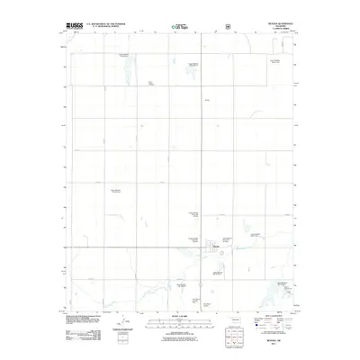
2011 Map of Reydon
USGS Topo · Published 2011About this map
Reydon serves as the primary hub in this western Oklahoma landscape, situated at the confluence of several local routes in Roger Mills County. The area is defined by a sophisticated water management system along the Washita River and its tributaries, characterized by a series of flood control structures such as Upper Washita Site 35 Dam, Upper Washita Site 53 Dam, and Upper Washita River Site 101 Dam. These reservoirs are integrated into the rolling topography where Rush Creek flows eastward toward the town site.
Find a feature on this map
30 named features on this map. Tap any name to fly to it.
Don’t see what you’re looking for? This feature index may not catch every label — zoom into the map to look around manually.
Map Details
Editions of this 2011 Reydon Map
This is the sole edition of this map. No revisions or reprints were ever made.
Other maps of this area

1954 · Amarillo
USGS Topo · 1:250,000

1955 · Clinton
USGS Topo · 1:250,000

1957 · Clinton
USGS Topo · 1:250,000

1958 · Amarillo
USGS Topo · 1:250,000

1961 · Reydon
USGS Topo · 1:62,500

1963 · Allison
USGS Topo · 1:24,000

1965 · Crawford
USGS Topo · 1:24,000

1966 · Durham
USGS Topo · 1:24,000

1967 · Gem
USGS Topo · 1:24,000

1967 · Hackberry Creek
USGS Topo · 1:24,000