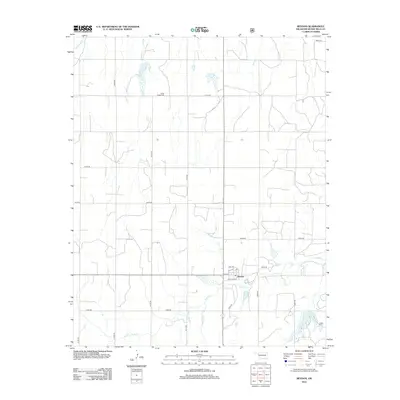
2012 Map of Reydon
USGS Topo · Published 2012About this map
Reydon serves as the primary hub of this Roger Mills County landscape, with a grid of local streets including Santa Fe Ave, 2nd Ave, and 5th Ave marking the town center. The surrounding countryside is defined by the winding course of the Washita River in the northwest and the multiple branches of Rush Cr flowing through the southern and eastern reaches. A significant point for local genealogy is the Union Chapel Cem, situated near the intersection of N1700 Rd and N1710 Rd. This survey captures the rural character of western Oklahoma, where a systematic network of section line roads like E0910 Rd and N1690 Rd provides access to the agricultural acreage and small water impoundments that dot the drainage basins of the local creeks.
Find a feature on this map
23 named features on this map. Tap any name to fly to it.
Don’t see what you’re looking for? This feature index may not catch every label — zoom into the map to look around manually.
Map Details
Editions of this 2012 Reydon Map
This is the sole edition of this map. No revisions or reprints were ever made.
Other maps of this area

1954 · Amarillo
USGS Topo · 1:250,000

1955 · Clinton
USGS Topo · 1:250,000

1957 · Clinton
USGS Topo · 1:250,000

1958 · Amarillo
USGS Topo · 1:250,000

1961 · Reydon
USGS Topo · 1:62,500

1963 · Allison
USGS Topo · 1:24,000

1965 · Crawford
USGS Topo · 1:24,000

1966 · Durham
USGS Topo · 1:24,000

1967 · Gem
USGS Topo · 1:24,000

1967 · Hackberry Creek
USGS Topo · 1:24,000