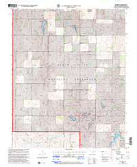
1998 Map of Reydon
USGS Topo · Published 2001About this map
The Black Kettle National Grassland dominates this portion of Roger Mills County, showing a landscape defined by conservation and resource extraction in the late 20th century. Numerous Gas Wells and Drill Holes are scattered across the terrain, illustrating the region's energy production history alongside traditional ranching, evidenced by the Cary Ranch Landing Strip. The town of Reydon serves as the primary settlement, situated near the headwaters of Rush Creek and supported by infrastructure such as Sewage Disposal Ponds and a Communication Tower.
Find a feature on this map
29 named features on this map. Tap any name to fly to it.
Don’t see what you’re looking for? This feature index may not catch every label — zoom into the map to look around manually.
Map Details
Editions of this 1998 Reydon Map
This is the sole edition of this map. No revisions or reprints were ever made.
Other maps of this area

1954 · Amarillo
USGS Topo · 1:250,000

1955 · Clinton
USGS Topo · 1:250,000

1957 · Clinton
USGS Topo · 1:250,000

1958 · Amarillo
USGS Topo · 1:250,000

1961 · Reydon
USGS Topo · 1:62,500

1963 · Allison
USGS Topo · 1:24,000

1965 · Crawford
USGS Topo · 1:24,000

1966 · Durham
USGS Topo · 1:24,000

1967 · Gem
USGS Topo · 1:24,000

1967 · Hackberry Creek
USGS Topo · 1:24,000