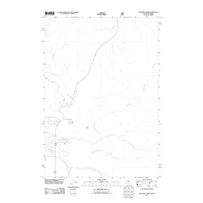
2011 Map of Richards Creek
USGS Topo · Published 2011About this map
Grayling Creek and its many tributaries define the hydrology of this Montana-Wyoming borderland in the early 21st century. The drainage network is particularly dense here, with Richards Creek, Duck Creek, and Gneiss Creek converging in the southern portion of the quadrangle. Human impact on the land is most visible near the intersection of local routes like Grayling Rd and Aspen Loop, where the Fir Ridge Cemetery sits adjacent to the road network. A notable point of interest is the uniquely named Real Close Dam located near the center of the sheet, south of Sandy Butte. The map details a landscape transition where named roads such as S Tepee Creek Rd and Cougar Creek Rd follow the natural contours of the mountain valleys, providing access to these high-elevation watercourses.
Find a feature on this map
15 named features on this map. Tap any name to fly to it.
Don’t see what you’re looking for? This feature index may not catch every label — zoom into the map to look around manually.
Map Details
Editions of this 2011 Richards Creek Map
This is the sole edition of this map. No revisions or reprints were ever made.
Other maps of this area

1885 · Gallatin
USGS Topo · 1:125,000

1885 · Gallatin
USGS Topo · 1:125,000

1901 · Gallatin
USGS Topo · 1:125,000

1908 · Gallatin
USGS Topo · 1:125,000

1911 · Gallatin
USGS Topo · 1:125,000

1955 · Ashton
USGS Topo · 1:250,000

1958 · Ashton
USGS Topo · 1:250,000

1958 · Madison Junction
USGS Topo · 1:62,500

1958 · Mount Holmes
USGS Topo · 1:62,500

1958 · West Yellowstone
USGS Topo · 1:62,500