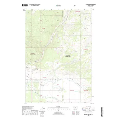
2020 Map of Richards Creek
USGS Topo · Published 2020About this map
Fir Ridge Cem and the adjacent Fir Ridge landmark sit near the boundary where Montana meets Wyoming, marking a high-elevation divide between public lands. The landscape is defined by the convergence of Gallatin National Forest and Yellowstone National Park, with the vast Madison Valley opening to the west. A complex network of waterways, including Grayling Cr, Duck Cr, and Richards Cr, drains these slopes into the valley floor. US Highway 191 provides the primary corridor through this wilderness, shadowed by historical routes like the Gneiss Creek Trail. The presence of the cemetery and numerous forest roads, such as S Tepee Creek Rd and Cougar Creek Rd, suggests a history of remote land management and early mountain access in this border region.
Find a feature on this map
42 named features on this map. Tap any name to fly to it.
Don’t see what you’re looking for? This feature index may not catch every label — zoom into the map to look around manually.
Map Details
Editions of this 2020 Richards Creek Map
This is the sole edition of this map. No revisions or reprints were ever made.
Other maps of this area

1885 · Gallatin
USGS Topo · 1:125,000

1885 · Gallatin
USGS Topo · 1:125,000

1901 · Gallatin
USGS Topo · 1:125,000

1908 · Gallatin
USGS Topo · 1:125,000

1911 · Gallatin
USGS Topo · 1:125,000

1955 · Ashton
USGS Topo · 1:250,000

1958 · Ashton
USGS Topo · 1:250,000

1958 · Madison Junction
USGS Topo · 1:62,500

1958 · Mount Holmes
USGS Topo · 1:62,500

1958 · West Yellowstone
USGS Topo · 1:62,500