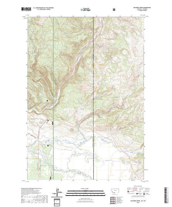
2024 Map of Richards Creek
USGS Topo · Published 2024About this map
Yellowstone National Park and the Gallatin National Forest meet in this high-altitude landscape along the Montana and Wyoming border. The terrain is defined by a series of major drainages, including the west-flowing Duck Creek, Grayling Creek, and Richards Creek, which feed toward the Madison Valley in the southwest corner. Transportation in this wilderness area is anchored by US Highway 191, which follows the path of Tepee Creek through the mountains. Local history and outdoor access are noted by features like the Fir Ridge Cem and several backcountry routes such as the Gneiss Creek Trl and Fir Ridge Trl. The map illustrates the convergence of federal lands, including the boundary between Gallatin and Park counties, while highlighting prominent landmarks such as Sandy Butte.
Find a feature on this map
22 named features on this map. Tap any name to fly to it.
Don’t see what you’re looking for? This feature index may not catch every label — zoom into the map to look around manually.
Map Details
Editions of this 2024 Richards Creek Map
This is the sole edition of this map. No revisions or reprints were ever made.
Other maps of this area

1885 · Gallatin
USGS Topo · 1:125,000

1885 · Gallatin
USGS Topo · 1:125,000

1901 · Gallatin
USGS Topo · 1:125,000

1908 · Gallatin
USGS Topo · 1:125,000

1911 · Gallatin
USGS Topo · 1:125,000

1955 · Ashton
USGS Topo · 1:250,000

1958 · Ashton
USGS Topo · 1:250,000

1958 · Madison Junction
USGS Topo · 1:62,500

1958 · Mount Holmes
USGS Topo · 1:62,500

1958 · West Yellowstone
USGS Topo · 1:62,500