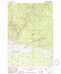
1986 Map of Richards Creek
USGS Topo · Published 1986About this map
Yellowstone National Park and the Gallatin National Forest converge in this high-elevation corner of the Madison Valley along the Montana and Wyoming border. The landscape is defined by a dense network of mountain drainage systems, including Grayling Creek, Duck Creek, and Gneiss Creek, which flow through the forested terrain. Evidence of human presence is sparse but specific, marked by the presence of a Pack Trail and a Gravel Pit near the western edge. Notable for local history, a small Cem is situated near the confluence of the larger streams, suggesting early valley settlement or traveler landmarks before this area became part of the protected park and forest systems. This 1980s field-checked survey highlights the transition from the valley floor to the prominent slopes of Sandy Butte.
Find a feature on this map
18 named features on this map. Tap any name to fly to it.
Don’t see what you’re looking for? This feature index may not catch every label — zoom into the map to look around manually.
Map Details
Editions of this 1986 Richards Creek Map
This is the sole edition of this map. No revisions or reprints were ever made.
Other maps of this area

1885 · Gallatin
USGS Topo · 1:125,000

1885 · Gallatin
USGS Topo · 1:125,000

1901 · Gallatin
USGS Topo · 1:125,000

1908 · Gallatin
USGS Topo · 1:125,000

1911 · Gallatin
USGS Topo · 1:125,000

1955 · Ashton
USGS Topo · 1:250,000

1958 · Ashton
USGS Topo · 1:250,000

1958 · Madison Junction
USGS Topo · 1:62,500

1958 · Mount Holmes
USGS Topo · 1:62,500

1958 · West Yellowstone
USGS Topo · 1:62,500