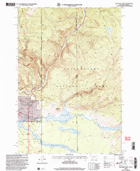
2000 Map of Richards Creek
USGS Topo · Published 2005About this map
Yellowstone National Park and Gallatin National Forest meet in this survey along the border of Montana and Wyoming. The landscape is defined by the high drainage systems of Grayling Creek and Richards Creek, which flow through the rugged terrain of the Madison Valley. While much of the area is protected wilderness, the map documents specific points of human activity and utility, including a Gravel Pit and a solitary Cem located near the confluence of local streams. Distinctive topographical landmarks such as Sandy Butte stand out against the network of waterways like Gneiss Creek and Cougar Creek. The boundary lines for the Hebgen Lake Ranger District and several county lines delineate the administrative management of this high-country ecosystem during the transition into the new millennium.
Find a feature on this map
22 named features on this map. Tap any name to fly to it.
Don’t see what you’re looking for? This feature index may not catch every label — zoom into the map to look around manually.
Map Details
Editions of this 2000 Richards Creek Map
This is the sole edition of this map. No revisions or reprints were ever made.
Other maps of this area

1885 · Gallatin
USGS Topo · 1:125,000

1885 · Gallatin
USGS Topo · 1:125,000

1901 · Gallatin
USGS Topo · 1:125,000

1908 · Gallatin
USGS Topo · 1:125,000

1911 · Gallatin
USGS Topo · 1:125,000

1955 · Ashton
USGS Topo · 1:250,000

1958 · Ashton
USGS Topo · 1:250,000

1958 · Madison Junction
USGS Topo · 1:62,500

1958 · Mount Holmes
USGS Topo · 1:62,500

1958 · West Yellowstone
USGS Topo · 1:62,500