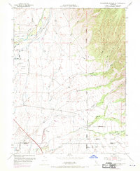
1952 Map of Richardson Springs NW
USGS Topo · Published 1970About this map
The boundary between Tehama Co and Butte Co defines this portion of the northern Sacramento Valley, where the terrain transitions from the alluvial plains of the west to the dissected foothills of the Cascade Range. Agricultural development is evident through the presence of the Kimball Ditch and various unnamed Irrigation Ditch systems feeding off Deer Creek. The landscape is a mix of cattle ranching and early aviation infrastructure, most notably marked by the U S Auxiliary Airfield north of the county line.
Find a feature on this map
45 named features on this map. Tap any name to fly to it.
Don’t see what you’re looking for? This feature index may not catch every label — zoom into the map to look around manually.
Map Details
Editions of this 1952 Richardson Springs NW Map
4 editions found
Other maps of this area

1886 · Lassen Peak
USGS Topo · 1:250,000

1890 · Red Bluff
USGS Topo · 1:250,000

1891 · Chico
USGS Topo · 1:125,000

1892 · Lassen Peak
USGS Topo · 1:250,000

1893 · Chico
USGS Topo · 1:125,000

1894 · Lassen Peak
USGS Topo · 1:250,000

1894 · Red Bluff
USGS Topo · 1:250,000

1895 · Chico
USGS Topo · 1:125,000

1904 · Vina
USGS Topo · 1:62,500

1905 · Tehama
USGS Topo · 1:62,500