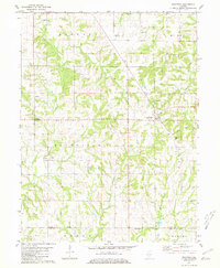
1981 Map of Richfield
USGS Topo · Published 1981About this map
Richfield and Kingston anchor this late 20th-century landscape at the border of Adams and Pike counties. The area is defined by its deep genealogical footprint, evidenced by over ten distinct family and community burial grounds, including the Broady Cem, Pearce Cem, and Drescher Cem scattered across the township lines. The terrain is intricately carved by numerous waterways like Coal Creek, Beebe Creek, and McCraney Creek, which create a complex system of wooded draws and ridges between cultivated fields.
Find a feature on this map
33 named features on this map. Tap any name to fly to it.
Don’t see what you’re looking for? This feature index may not catch every label — zoom into the map to look around manually.
Map Details
Editions of this 1981 Richfield Map
This is the sole edition of this map. No revisions or reprints were ever made.
Other maps of this area

1925 · Liberty
USGS Topo · 1:62,500

1926 · Pittsfield
USGS Topo · 1:62,500

1926 · Mt Sterling
USGS Topo · 1:62,500

1927 · Liberty
USGS Topo · 1:62,500

1929 · Mt Sterling
USGS Topo · 1:62,500

1931 · Barry
USGS Topo · 1:62,500

1936 · Barry
USGS Topo · 1:48,000

1944 · Barry
USGS Topo · 1:62,500

1948 · Quincy
USGS Topo · 1:250,000

1956 · Quincy
USGS Topo · 1:250,000