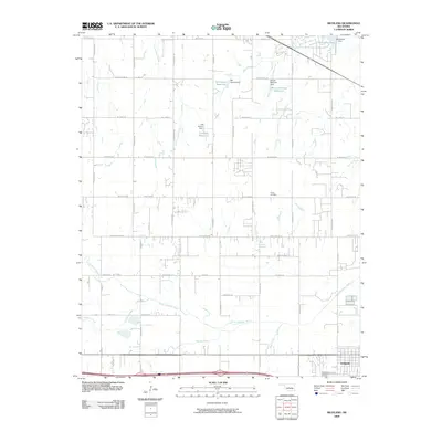
2009 Map of Richland
USGS Topo · Published 2009About this map
The North Canadian River meanders across the southern landscape of this 2009 quadrangle, defining the low-lying terrain near Yukon. The area is characterized by a high density of small-scale water management projects, including the Bill Garms Reservoir, J B Rivers Reservoir, and Brown-McClure Reservoir. These features, often associated with family-named dams like Northwood Dam and Bill Garms Dam, reflect the localized agricultural and residential water needs in this part of Oklahoma.
Find a feature on this map
50 named features on this map. Tap any name to fly to it.
Don’t see what you’re looking for? This feature index may not catch every label — zoom into the map to look around manually.
Map Details
Editions of this 2009 Richland Map
This is the sole edition of this map. No revisions or reprints were ever made.
Other maps of this area

1892 · Kingfisher
USGS Topo · 1:125,000

1893 · Oklahoma City
USGS Topo · 1:62,500

1893 · Minco
USGS Topo · 1:62,500

1895 · Kingfisher
USGS Topo · 1:125,000

1904 · Chickasha
USGS Topo · 1:125,000

1954 · Oklahoma City
USGS Topo · 1:250,000

1956 · Oklahoma City
USGS Topo · 1:62,500

1957 · Oklahoma City
USGS Topo · 1:250,000

1963 · Oklahoma City
USGS Topo · 1:250,000
1966 · Minco NE
USGS Topo · 1:24,000