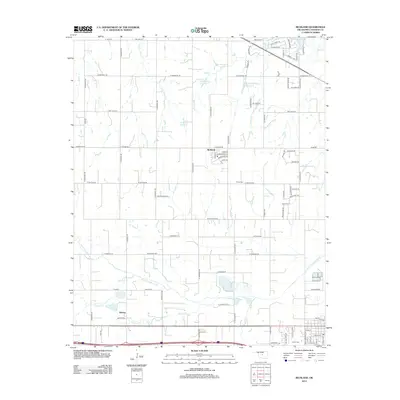
2012 Map of Richland
USGS Topo · Published 2012About this map
The North Canadian River winds through the southern reaches of this landscape, anchoring a region defined by agricultural heritage and water management. Near the river, the small community of Banner sits along a major corridor, while the settlement of Richland serves as a central hub further north. The map documents several significant local water features, including the Bill Garms Reservoir, Brown-McClure Reservoir, and J B Rivers Reservoir, illustrating how the land has been engineered for ranching or irrigation. Genealogy and local history researchers will find the Frisco Cem on W Britton Rd, alongside a network of tributary streams like Uncle Johns Cr and Purcell Cr that crisscross the section lines of Canadian and Oklahoma counties.
Find a feature on this map
87 named features on this map. Tap any name to fly to it.
Don’t see what you’re looking for? This feature index may not catch every label — zoom into the map to look around manually.
Map Details
Editions of this 2012 Richland Map
This is the sole edition of this map. No revisions or reprints were ever made.
Other maps of this area

1892 · Kingfisher
USGS Topo · 1:125,000

1893 · Oklahoma City
USGS Topo · 1:62,500

1893 · Minco
USGS Topo · 1:62,500

1895 · Kingfisher
USGS Topo · 1:125,000

1904 · Chickasha
USGS Topo · 1:125,000

1954 · Oklahoma City
USGS Topo · 1:250,000

1956 · Oklahoma City
USGS Topo · 1:62,500

1957 · Oklahoma City
USGS Topo · 1:250,000

1963 · Oklahoma City
USGS Topo · 1:250,000
1966 · Minco NE
USGS Topo · 1:24,000