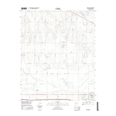
2016 Map of Richland
USGS Topo · Published 2016About this map
Richland and the surrounding plains of Central Oklahoma are defined by the winding course of the N Canadian River as it moves through the southern half of this area. The landscape shows a distinct transition from the agricultural grid of the northwest towards the growing suburban reach of Yukon in the southeast. Numerous private water features, including Bill Garms Reservoir, J B Rivers Reservoir, and the Brown-McClure Reservoir, dot the terrain, reflecting the region's managed water resources for ranching and local utility. Along the western edge, the small community of Banner sits near Purcell Cr, while the historic Frisco Cem remains a quiet landmark north of the river. This survey captures the detailed intersection of rural township lines with modern residential developments like those around Northwood Lake.
Find a feature on this map
95 named features on this map. Tap any name to fly to it.
Don’t see what you’re looking for? This feature index may not catch every label — zoom into the map to look around manually.
Map Details
Editions of this 2016 Richland Map
This is the sole edition of this map. No revisions or reprints were ever made.
Other maps of this area

1892 · Kingfisher
USGS Topo · 1:125,000

1893 · Oklahoma City
USGS Topo · 1:62,500

1893 · Minco
USGS Topo · 1:62,500

1895 · Kingfisher
USGS Topo · 1:125,000

1904 · Chickasha
USGS Topo · 1:125,000

1954 · Oklahoma City
USGS Topo · 1:250,000

1956 · Oklahoma City
USGS Topo · 1:62,500

1957 · Oklahoma City
USGS Topo · 1:250,000

1963 · Oklahoma City
USGS Topo · 1:250,000
1966 · Minco NE
USGS Topo · 1:24,000