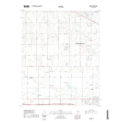
2018 Map of Richland
USGS Topo · Published 2018About this map
N Canadian River winds through the southern reaches of this landscape, anchoring a corridor of small settlements and rural crossroads between larger municipal centers. The unincorporated community of Richland occupies the central portion of the sheet, characterized by a grid of agricultural section lines and localized residential streets like Arrowhead Dr and Tomahawk Dr. Further south, the settlement of Banner sits near the banks of Purcell Creek, illustrating the historical importance of water access for early Oklahoma homesteads.
Find a feature on this map
67 named features on this map. Tap any name to fly to it.
Don’t see what you’re looking for? This feature index may not catch every label — zoom into the map to look around manually.
Map Details
Editions of this 2018 Richland Map
This is the sole edition of this map. No revisions or reprints were ever made.
Other maps of this area

1892 · Kingfisher
USGS Topo · 1:125,000

1893 · Oklahoma City
USGS Topo · 1:62,500

1893 · Minco
USGS Topo · 1:62,500

1895 · Kingfisher
USGS Topo · 1:125,000

1904 · Chickasha
USGS Topo · 1:125,000

1954 · Oklahoma City
USGS Topo · 1:250,000

1956 · Oklahoma City
USGS Topo · 1:62,500

1957 · Oklahoma City
USGS Topo · 1:250,000

1963 · Oklahoma City
USGS Topo · 1:250,000
1966 · Minco NE
USGS Topo · 1:24,000