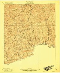
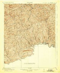
1916 Map of Richlands
USGS Topo · Published 1916About this map
Richlands and the coal-rich valleys of Southwest Virginia are depicted here during a period of heavy industrialization and mountain settlement. The Norfolk and Western RR follows the Clinch River, connecting a string of towns from Honaker and Swords Creek to Raven and Cedar Bluff. This rail infrastructure, combined with the Lumber RR and numerous small hollows, reveals an economy deeply tied to the extraction of natural resources from the surrounding ridges.
Find a feature on this map
87 named features on this map. Tap any name to fly to it.
Don’t see what you’re looking for? This feature index may not catch every label — zoom into the map to look around manually.
Map Details
Editions of this 1916 Richlands Map
5 editions found
Other maps of this area

1886 · Grundy
USGS Topo · 1:125,000

1890 · Grundy
USGS Topo · 1:125,000

1891 · Tazewell
USGS Topo · 1:125,000

1891 · Abingdon
USGS Topo · 1:125,000

1892 · Grundy
USGS Topo · 1:125,000

1894 · Abingdon
USGS Topo · 1:125,000

1895 · Tazewell
USGS Topo · 1:125,000

1897 · Tazewell
USGS Topo · 1:125,000

1897 · Bristol
USGS Topo · 1:125,000

1902 · Bristol
USGS Topo · 1:125,000