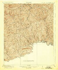
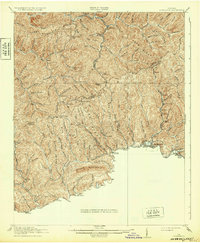
1916 Map of Richlands
USGS Topo · Published 1932About this map
The Clinch River corridor anchors this early 20th-century survey of the Appalachian coalfields, where the Norfolk and Western railway snakes through the valley to serve industrial hubs like Richlands and Cedar Bluff. The landscape is defined by massive parallel formations including Jewell Ridge, Red Root Ridge, and Keen Mountain, which separate isolated hollows and high-elevation settlements. Evidence of a rural society in transition is found in the numerous scattered educational sites like Doggy Bottom School, Whitewood School, and Pine Creek School. While the river valleys show concentrated development at Raven and Doran, the northern ridges remain dominated by small mountain communities and natural features like the Gap of Sandy and Wolfpen Knob, illustrating the logistical challenges of the era's extraction-based economy.
Find a feature on this map
62 named features on this map. Tap any name to fly to it.
Don’t see what you’re looking for? This feature index may not catch every label — zoom into the map to look around manually.
Map Details
Editions of this 1916 Richlands Map
5 editions found
Other maps of this area

1886 · Grundy
USGS Topo · 1:125,000

1890 · Grundy
USGS Topo · 1:125,000

1891 · Tazewell
USGS Topo · 1:125,000

1891 · Abingdon
USGS Topo · 1:125,000

1892 · Grundy
USGS Topo · 1:125,000

1894 · Abingdon
USGS Topo · 1:125,000

1895 · Tazewell
USGS Topo · 1:125,000

1897 · Tazewell
USGS Topo · 1:125,000

1897 · Bristol
USGS Topo · 1:125,000

1902 · Bristol
USGS Topo · 1:125,000