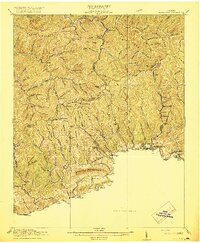
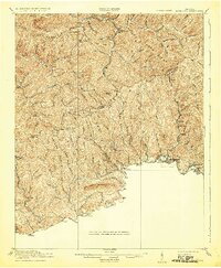
1916 Map of Richlands
USGS Topo · Published 1916About this map
The Clinch River flows through the southern portion of this region, providing the corridor for the Norfolk and Western railroad and anchoring the growing communities of Richlands and Cedar Bluff. Surveyed just before the United States entered the Great War, the landscape is defined by the sharp transition from river-level industry to the high ridges of Keen Mountain and Stone Mountain. Numerous small schoolhouses, such as Antioch School, Whitewood School, and Lane School, are scattered across the narrow valleys and ridges, reflecting a decentralized rural society.
Find a feature on this map
99 named features on this map. Tap any name to fly to it.
Don’t see what you’re looking for? This feature index may not catch every label — zoom into the map to look around manually.
Map Details
Editions of this 1916 Richlands Map
5 editions found
Other maps of this area

1886 · Grundy
USGS Topo · 1:125,000

1890 · Grundy
USGS Topo · 1:125,000

1891 · Tazewell
USGS Topo · 1:125,000

1891 · Abingdon
USGS Topo · 1:125,000

1892 · Grundy
USGS Topo · 1:125,000

1894 · Abingdon
USGS Topo · 1:125,000

1895 · Tazewell
USGS Topo · 1:125,000

1897 · Tazewell
USGS Topo · 1:125,000

1897 · Bristol
USGS Topo · 1:125,000

1902 · Bristol
USGS Topo · 1:125,000