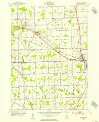
1952 Map of Richmond
USGS Topo · Published 1954About this map
The town of Richmond anchors this mid-century survey of the Macomb and St. Clair County border, a landscape defined by an extensive network of drainage ditches and small creeks. The agricultural character of the era is evident in the high density of rural schools, many of which were already noted as defunct, such as Howe Sch and Clay Road Sch. The Grand Trunk railroad cuts diagonally through the townships of Richmond and Lenox, serving as a primary transit artery alongside traditional routes like Gratiot Ave. Local genealogy is well-represented through several family and community landmarks, including the Bates Cem and Richards Cem, while the terrain is marked by features like Highbank Hill and the winding Coon Creek. This 1952 revision provides a clear record of the transition from a purely agrarian school-district system toward modern consolidated patterns.
Find a feature on this map
56 named features on this map. Tap any name to fly to it.
Don’t see what you’re looking for? This feature index may not catch every label — zoom into the map to look around manually.
Map Details
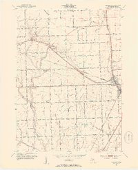
Editions of this 1952 Richmond Map
2 editions found
Other maps of this area

1912 · Mt Clemens
USGS Topo · 1:62,500

1914 · Armada
USGS Topo · 1:62,500

1914 · Algonac
USGS Topo · 1:62,500

1928 · Armada
USGS Topo · 1:62,500

1928 · Hicky
USGS Topo · 1:62,500

1929 · Mt Clemens
USGS Topo · 1:62,500

1936 · New Haven
USGS Topo · 1:31,680

1936 · Waldenburg
USGS Topo · 1:31,680

1936 · New Baltimore
USGS Topo · 1:31,680

1939 · New Baltimore
USGS Topo · 1:24,000