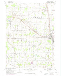
1968 Map of Richmond
USGS Topo · Published 1974About this map
The Grand Trunk Western railroad cuts a diagonal path through this corner of Macomb and St. Clair Counties, serving as the primary corridor for the industrial and agricultural output of Richmond and Armada. This survey reveals a landscape deeply connected by a complex system of drainage and irrigation, with names like the Wheeler Drain, Dixon Drain, and Ray-Lenox Drain detailing the local management of the watershed leading toward the Salt River.
Find a feature on this map
74 named features on this map. Tap any name to fly to it.
Don’t see what you’re looking for? This feature index may not catch every label — zoom into the map to look around manually.
Map Details
Editions of this 1968 Richmond Map
2 editions found
Other maps of this area

1912 · Mt Clemens
USGS Topo · 1:62,500

1914 · Armada
USGS Topo · 1:62,500

1914 · Algonac
USGS Topo · 1:62,500

1928 · Armada
USGS Topo · 1:62,500

1928 · Hicky
USGS Topo · 1:62,500

1929 · Mt Clemens
USGS Topo · 1:62,500

1936 · New Haven
USGS Topo · 1:31,680

1936 · Waldenburg
USGS Topo · 1:31,680

1936 · New Baltimore
USGS Topo · 1:31,680

1939 · New Baltimore
USGS Topo · 1:24,000