
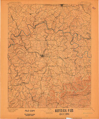
1897 Map of Richmond
USGS Topo · Published 1897About this map
The Kentucky River carves a deep, winding path through the Bluegrass region, serving as the central dividing line between Fayette, Clark, and Madison counties. This late-nineteenth-century landscape is defined by its sophisticated rail network, where the Kentucky Central R.R. and the Richmond Irvine and Beattyville R.R. intersect at the regional hub of Richmond. Further north, Winchester appears as a major junction for the Chesapeake and Ohio R.R. and the Lexington and Eastern R.R..
Find a feature on this map
159 named features on this map. Tap any name to fly to it.
Don’t see what you’re looking for? This feature index may not catch every label — zoom into the map to look around manually.
Map Details
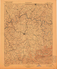
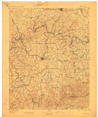
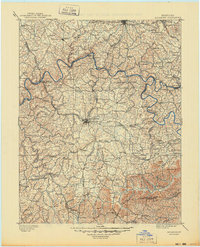
Editions of this 1897 Richmond Map
5 editions found
Other maps of this area

1891 · Manchester
USGS Topo · 1:125,000

1892 · Richmond
USGS Topo · 1:125,000

1892 · Beattyville
USGS Topo · 1:125,000

1893 · London
USGS Topo · 1:125,000

1897 · London
USGS Topo · 1:125,000

1905 · Harrodsburg
USGS Topo · 1:125,000

1906 · Georgetown
USGS Topo · 1:62,500

1908 · Georgetown
USGS Topo · 1:62,500

1927 · Lexington
USGS Topo · 1:48,000

1929 · Lexington
USGS Topo · 1:62,500