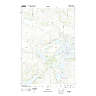
2013 Map of Richmond
USGS Topo · Published 2013About this map
Richmond serves as the focal point for this Stearns County landscape, positioned along the banks of the Sauk River in a region defined by an intricate network of glacial lakes and waterways. The map illustrates a developed recreation and residential pattern, particularly concentrated around the shores of Big Lake, Cedar Island Lake, and Horseshoe Lake. The local infrastructure is deeply tied to this water-rich geography, with major routes like MN-23 and Co HWY-23 navigating between the numerous basins. Notable community landmarks include the Saints Peter and Paul Cem and the local Post Office in the village center. The southern portion of the quadrangle shows a strong emphasis on seasonal residency and tourism, evidenced by the Morning Star Resort Campground, Your Haven Campground, and Cozy Corner Campground, highlighting the area's long-standing draw for those seeking the Minnesota lake life.
Find a feature on this map
87 named features on this map. Tap any name to fly to it.
Don’t see what you’re looking for? This feature index may not catch every label — zoom into the map to look around manually.
Map Details
Editions of this 2013 Richmond Map
This is the sole edition of this map. No revisions or reprints were ever made.
Other maps of this area

1953 · Saint Cloud
USGS Topo · 1:250,000

1957 · Saint Cloud
USGS Topo · 1:250,000

1958 · Saint Cloud
USGS Topo · 1:250,000

1965 · Farming
USGS Topo · 1:24,000

1965 · St Martin
USGS Topo · 1:24,000

1965 · Avon
USGS Topo · 1:24,000

1967 · Cold Spring
USGS Topo · 1:24,000

1967 · Paynesville
USGS Topo · 1:24,000

1967 · Lake Koronis
USGS Topo · 1:24,000

1967 · Richmond
USGS Topo · 1:24,000