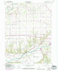
1963 Map of Richvalley
USGS Topo · Published 1994About this map
The Wabash River and the Eel River define the northern and southern reaches of this landscape on the boundary between Miami and Wabash Counties. The settlement of Richvalley sits as a central hub along the Norfolk and Western railroad corridor, supported by an intricate network of rural drainage systems like Paw Paw Ditch and Beamer Ditch that transformed this terrain for agricultural use. Genealogists will find significant local landmarks including Wallace Cem, Richvalley Cem, and the Francis Godfroy Cem located near the riverbanks. The map also documents smaller rural communities such as Erie and Asher, alongside family-named infrastructure like Flora Road and Storey Road. A notable Oil Well and the Roadside Park near Gilbert Branch reflect the mid-century industrial and recreational development of the Indiana countryside.
Find a feature on this map
54 named features on this map. Tap any name to fly to it.
Don’t see what you’re looking for? This feature index may not catch every label — zoom into the map to look around manually.
Map Details
Editions of this 1963 Richvalley Map
3 editions found
Other maps of this area

1951 · Peru
USGS Topo · 1:24,000

1951 · Bunker Hill
USGS Topo · 1:24,000

1951 · Richvalley
USGS Topo · 1:24,000

1952 · Wabash
USGS Topo · 1:24,000

1953 · Somerset
USGS Topo · 1:24,000

1953 · Peoria
USGS Topo · 1:24,000

1953 · Danville
USGS Topo · 1:250,000

1953 · Muncie
USGS Topo · 1:250,000

1955 · Danville
USGS Topo · 1:250,000

1956 · Muncie
USGS Topo · 1:250,000