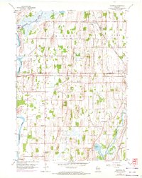
1959 Map of Richwood
USGS Topo · Published 1972About this map
Glacial drumlins and river valleys define this landscape along the border of Dodge and Jefferson counties. The Crawfish River and Beaverdam River converge in the northwest near Mud Lake, while the Rock River winds through the southeast corner near Grellton. This 1959 survey, updated with 1971 aerial photogrammetry, documents a rural landscape where agricultural life was anchored by local institutions such as St Marks Sch, Hilltop Sch, and Mamre Ch. The presence of numerous Gravel Pits and a Quarry indicates the importance of local mineral extraction to the regional economy. Transportation through these townships is dominated by the Chicago Milwaukee St Paul and Pacific railroad, which bisects the quadrangle, serving small rail-side communities like Richwood.
Find a feature on this map
28 named features on this map. Tap any name to fly to it.
Don’t see what you’re looking for? This feature index may not catch every label — zoom into the map to look around manually.
Map Details
Editions of this 1959 Richwood Map
2 editions found
Other maps of this area

1891 · Waterloo
USGS Topo · 1:62,500

1892 · Watertown
USGS Topo · 1:62,500

1894 · Waterloo
USGS Topo · 1:62,500

1894 · Watertown
USGS Topo · 1:62,500

1910 · Waterloo
USGS Topo · 1:62,500

1955 · Beaver Dam
USGS Topo · 1:62,500

1955 · Horicon
USGS Topo · 1:62,500

1957 · Madison
USGS Topo · 1:250,000
1959 · Richwood
USGS Topo · 1:24,000
1959 · Waterloo
USGS Topo · 1:24,000