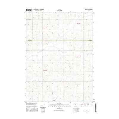
2015 Map of Ricketts
USGS Topo · Published 2015About this map
Ricketts sits at the southern edge of this western Iowa landscape, where the Middle Soldier River and Soldier River drain through a grid of agricultural section lines. The terrain is defined by the sharp transition between high ridges and narrow creek bottoms, particularly along Beaver Cr and near the Beaver Creek Bridge. The map shows a meticulous county road network, including Co Hwy L51 and Co Rd D54, which link the farmsteads of the Willow Creek watershed. Located on the border of Ida and Crawford counties, this 2015 survey reveals the persistence of the township-and-range layout across the Loess Hills region, where naming conventions for arterial roads like German Ave and Carriage Ave reflect the local heritage and transport history of the rural prairie.
Find a feature on this map
30 named features on this map. Tap any name to fly to it.
Don’t see what you’re looking for? This feature index may not catch every label — zoom into the map to look around manually.
Map Details
Editions of this 2015 Ricketts Map
This is the sole edition of this map. No revisions or reprints were ever made.
Other maps of this area

1954 · Fort Dodge
USGS Topo · 1:250,000

1957 · Fort Dodge
USGS Topo · 1:250,000

1958 · Fort Dodge
USGS Topo · 1:250,000

1967 · Ida Grove
USGS Topo · 1:24,000

1967 · Battle Creek
USGS Topo · 1:24,000

1969 · Danbury
USGS Topo · 1:24,000

1969 · Holstein SW
USGS Topo · 1:24,000

1971 · Ricketts
USGS Topo · 1:24,000

1971 · Ute
USGS Topo · 1:24,000

1971 · Schleswig
USGS Topo · 1:24,000