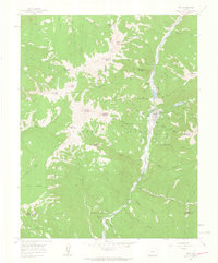
1960 Map of Rico
USGS Topo · Published 1963About this map
The mountain town of Rico serves as the focal point of this survey, situated along the Dolores River during a period of industrial transition. The landscape is heavily marked by its mining history, with numerous operations like the Enterprise Mine, Union Carbonate Mine, and Aztec Mine lining the slopes of Newman Hill and Dolores Mountain. Evidence of early transportation infrastructure is visible in the Old Railroad Grade that follows the river valley, while the Rico Ranger Station indicates the management of the surrounding San Juan National Forest. The map captures a high-elevation terrain defined by prominent peaks such as Expectation Mountain and Storm Peak, where pack trails like the Highline Trail and Telephone Trail provided essential access to remote claims and summits.
Find a feature on this map
71 named features on this map. Tap any name to fly to it.
Don’t see what you’re looking for? This feature index may not catch every label — zoom into the map to look around manually.
Map Details
Editions of this 1960 Rico Map
4 editions found
Other maps of this area

1897 · Rico
USGS Topo · 1:62,500

1897 · Telluride
USGS Topo · 1:62,500

1898 · Engineer Mountain
USGS Topo · 1:62,500

1898 · Rico
USGS Topo · 1:62,500

1899 · Rico
USGS Topo · 1:62,500

1900 · Engineer Mountain
USGS Topo · 1:62,500

1904 · Telluride
USGS Topo · 1:62,500

1908 · Engineer Mountain
USGS Topo · 1:62,500

1945 · Durango
USGS Topo · 1:250,000

1953 · Mount Wilson
USGS Topo · 1:24,000