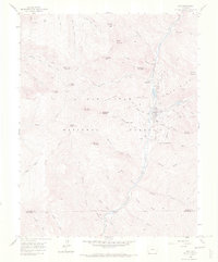
1960 Map of Rico
USGS Topo · Published 1971About this map
Mining operations and high-altitude geography define the landscape around Rico, situated along the Dolores River in the heart of the San Juan National Forest. This 1960 field-checked survey documents a transition in the region's industrial life, showing an extensive network of mineral claims and mines such as the Enterprise Mine, Nora Lily Mine, and Worlds Fair Prospect. The settlement of Deadwood and the presence of the Rico Ranger Sta reflect the community's dual reliance on resource extraction and federal land management. Evidence of former transportation infrastructure is visible through the Railroad Grade and an Aerial Tram near Newman Hill, marking the path of ores once hauled from the steep slopes of Expectation Mountain and Dolores Mountain. The map also captures several Settling Ponds and a Gaging Sta along the river, illustrating the managed intersection of mountain hydrology and silver-era industry.
Find a feature on this map
81 named features on this map. Tap any name to fly to it.
Don’t see what you’re looking for? This feature index may not catch every label — zoom into the map to look around manually.
Map Details
Editions of this 1960 Rico Map
4 editions found
Other maps of this area

1897 · Rico
USGS Topo · 1:62,500

1897 · Telluride
USGS Topo · 1:62,500

1898 · Engineer Mountain
USGS Topo · 1:62,500

1898 · Rico
USGS Topo · 1:62,500

1899 · Rico
USGS Topo · 1:62,500

1900 · Engineer Mountain
USGS Topo · 1:62,500

1904 · Telluride
USGS Topo · 1:62,500

1908 · Engineer Mountain
USGS Topo · 1:62,500

1945 · Durango
USGS Topo · 1:250,000

1953 · Mount Wilson
USGS Topo · 1:24,000