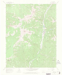
1960 Map of Rico
USGS Topo · Published 1971About this map
Rico occupies a narrow valley floor in the high San Juan Mountains, serving as the central hub for a landscape defined by 19th-century silver and base metal extraction. The settlement is flanked by peaks like Anchor Mountain and Dolores Mountain, with the Dolores River providing the primary corridor for movement. An Old Railroad Grade traces the riverbank, indicating the departed industrial infrastructure that once supported the numerous workings dotting the surrounding gulches.
Find a feature on this map
69 named features on this map. Tap any name to fly to it.
Don’t see what you’re looking for? This feature index may not catch every label — zoom into the map to look around manually.
Map Details
Editions of this 1960 Rico Map
4 editions found
Other maps of this area

1897 · Rico
USGS Topo · 1:62,500

1897 · Telluride
USGS Topo · 1:62,500

1898 · Engineer Mountain
USGS Topo · 1:62,500

1898 · Rico
USGS Topo · 1:62,500

1899 · Rico
USGS Topo · 1:62,500

1900 · Engineer Mountain
USGS Topo · 1:62,500

1904 · Telluride
USGS Topo · 1:62,500

1908 · Engineer Mountain
USGS Topo · 1:62,500

1945 · Durango
USGS Topo · 1:250,000

1953 · Mount Wilson
USGS Topo · 1:24,000