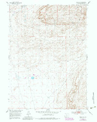
1953 Map of Riddle Cut
USGS Topo · Published 1983About this map
Stone Ranch stands as a lonely marker of human activity in this high-desert landscape, located near the headwaters of Stone Creek. The terrain is defined by the elevation of Table Mountain to the north and the Haystack Mountains to the south, with a geography characterized by undulating Sand Dunes and sparse water sources. The map captures a moment in the mid-20th century before late-century revisions, showing a landscape primarily utilized for transit and ranching. The namesake Riddle Cut and the nearby Riddle Spring suggest a passage through the high country, while multiple pipelines cross the quadrangle, indicating the region's role in energy infrastructure. These industrial lines contrast with the scattered springs that once dictated the movement of livestock and settlers in this part of Carbon County.
Find a feature on this map
14 named features on this map. Tap any name to fly to it.
Don’t see what you’re looking for? This feature index may not catch every label — zoom into the map to look around manually.
Map Details
Editions of this 1953 Riddle Cut Map
2 editions found
Other maps of this area

1953 · Bradley Peak
USGS Topo · 1:24,000

1953 · Wild Horse Mountain
USGS Topo · 1:24,000

1953 · Ferris
USGS Topo · 1:24,000

1953 · Riddle Cut
USGS Topo · 1:24,000

1953 · Lone Haystack Mountain
USGS Topo · 1:24,000

1953 · Rawlins NW
USGS Topo · 1:24,000

1954 · Rawlins
USGS Topo · 1:250,000

1955 · Casper
USGS Topo · 1:250,000

1956 · Rawlins Peak
USGS Topo · 1:62,500

1958 · Rawlins
USGS Topo · 1:250,000