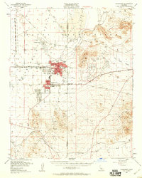
1953 Map of Ridgecrest
USGS Topo · Published 1960About this map
The Naval Ordnance Test Station dominates this high-desert landscape in the early 1950s, bridging the gap between the burgeoning settlements of China Lake and Ridgecrest. This era marks a significant transition from the region's mining roots to its post-war role as a center for military research and aviation. Near the central hubs, local life is documented through established landmarks like Burroughs High Sch and Richmond Sch, alongside civic amenities like the Ridgecrest Hospital and a Drive-in Theater.
Find a feature on this map
38 named features on this map. Tap any name to fly to it.
Don’t see what you’re looking for? This feature index may not catch every label — zoom into the map to look around manually.
Map Details
Editions of this 1953 Ridgecrest Map
4 editions found

Other maps of this area

1903 · Randsburg
USGS Topo · 1:62,500

1911 · Randsburg
USGS Topo · 1:62,500

1912 · Randsburg
USGS Topo · 1:62,500

1915 · Searles Lake
USGS Topo · 1:250,000

1943 · Inyokern
USGS Topo · 1:62,500

1943 · Saltdale
USGS Topo · 1:62,500

1947 · Trona
USGS Topo · 1:250,000

1948 · Trona
USGS Topo · 1:250,000

1949 · Trona
USGS Topo · 1:62,500

1949 · Searles Lake
USGS Topo · 1:62,500