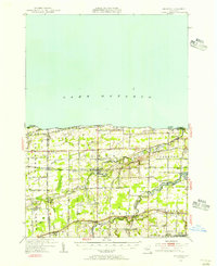
1950 Map of Ridgeway
USGS Topo · Published 1956About this map
Lake Ontario borders the northern edge of this Orleans County landscape, where fruit orchards and agricultural fields meet the southern shore. The village of Lyndonville serves as a central hub, connected by the New York Central railroad which cuts through the heart of the territory. Further south, the Erie Canal forms a vital historic transit corridor, passing through settlements like Eagle Harbor.
Find a feature on this map
57 named features on this map. Tap any name to fly to it.
Don’t see what you’re looking for? This feature index may not catch every label — zoom into the map to look around manually.
Map Details
Editions of this 1950 Ridgeway Map
2 editions found
Other maps of this area

1897 · Albion
USGS Topo · 1:62,500

1897 · Olcott
USGS Topo · 1:62,500

1897 · Medina
USGS Topo · 1:62,500

1897 · Lockport
USGS Topo · 1:62,500

1897 · Oak Orchard
USGS Topo · 1:62,500

1897 · Ridgeway
USGS Topo · 1:62,500

1899 · Niagara
USGS Topo · 1:125,000

1902 · Lockport
USGS Topo · 1:62,500

1905 · Lockport
USGS Topo · 1:62,500

1944 · Ashwood
USGS Topo · 1:31,680