
1971 Map of Ridott
USGS Topo · Published 1974About this map
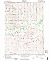
The meandering Pecatonica River defines the central corridor of this northern Illinois landscape, creating distinctive features like Sumner Island. The village of Ridott serves as the primary hub, situated where the Illinois Central Gulf Railroad parallels the river's path. The surrounding agricultural sections are dotted with landmarks vital for family history research, including the Holland Church and several rural burying grounds like Ridott Center Cem and Wagner Cem.
Find a feature on this map
55 named features on this map. Tap any name to fly to it.
Don’t see what you’re looking for? This feature index may not catch every label — zoom into the map to look around manually.
Map Details
Editions of this 1971 Ridott Map
2 editions found
Other maps of this area

1922 · Oregon
USGS Topo · 1:62,500

1924 · Oregon
USGS Topo · 1:62,500

1932 · Pecatonica
USGS Topo · 1:62,500

1936 · Pecatonica
USGS Topo · 1:62,500

1939 · Freeport
USGS Topo · 1:48,000

1942 · Forreston
USGS Topo · 1:62,500

1944 · Freeport
USGS Topo · 1:62,500

1945 · Forreston
USGS Topo · 1:62,500

1954 · Rockford
USGS Topo · 1:250,000

1955 · Rockford
USGS Topo · 1:250,000